What are the Best Places to Desert Hike in Phoenix?
With so many hiking options in Arizona sometimes it can be hard to choose. Arizona has more designated wilderness and National Forest land than any state in the Union, including Alaska. Given this, you can be certain that you can find somewhere to be one with the Earth. Arizona is home to three National Parks (Grand Canyon, Petrified Forest, Saguaro), about 7 billion National Monuments (Agua Fria, Sonoran Desert, Chiricahua, Sunset Crater, et al) that preserve things from Puebloan Ruins to the magnificent and unique “sky islands” to still-active volcanoes to Old West Pioneer sites, and hundreds of thousands of acres of National Forest and BLM Land. All of this adds up to some incredibly diverse and spectacular hiking opportunities, many of which are right near the capital city of Phoenix.
The Valley of the Sun
Phoenix, with the 5th largest population in the country (which always gets an eyebrow-raising reaction from nearly every person to which I tell this fun fact), can be a surprising and veritable bonanza of hiking if one knows where to look (or even if they don’t). There are mountains on every edge of the valley and even some in the central valley which yield some of the best views of the city. Phoenix has been designated as some variation of the “best big city for enjoying the outdoors” by nearly every major outdoor and hiking publication (Outside, Backpacker, Climbing Magazine to name a couple).
The hiking is particularly interesting here, as the summits of the many Phoenix mountains lend a sense of just how vast this city is, especially at night when the twinkle from city lights below seem to stretch out beyond the horizon. What else would you expect from one of the largest cities in the nation? Here are five of the best places in The Valley to get out and see something beautiful, including some of the most interesting geology that one may find anywhere.
What Makes the Sonoran Desert look this way?
Phoenix is set in the geologic province known as the Basin and Range. The Basin and Range also contains the cities of Tucson, Las Vegas and Salt Lake City and stretches west nearly to Los Angeles, terminating at the San Andreas Fault. This province is precisely what it sounds like; large sediment-collecting basins studded by fault-bounded mountain ranges. Go ahead, take a look at a topographic map. Go Ahead, I’ll wait. What you’ve likely noticed is that all of the mountain ranges strike in the same direction; northwest to southeast.
This uniquely conforming layout is due the geologic forces at work, the tectonic stress known as extension. Roughly 15 million years ago, the North American Plate began to “slide” out over the Farallon and Pacific tectonic plates; that is, the western portion of North America was once rumpled and crumpled like a rug, and now that rug, having reached its maximum rumply thickness and the forces of the surface friction below being reduced, has began to slowly slide back out over the floor.
See for yourself!
Perform this experiment yourself with a rug in your home, and the result that will show is that while un-rumpling, the carpet will very likely have parallel linear features that resemble mountains, while between those mountains lie depressions, or basins. This action has created the landscape laid out before you (on a summit), and is the entire reason you are even standing on this particular summit looking out over 75 miles of a city in the desert.
Remember this basic fact – geology dictates topography. This is true everywhere you may travel in the world. From the tallest mountains to the deepest oceans, from canyons to mesas, from beaches to windswept plains, the geologic forces acting upon those areas for the preceding many millions of years have yielded the result you view right this moment. Enjoy! Here are The Goat’s Top 5 hiking areas in Phoenix:
Desert Hiking Tips
One Major Tip: If attempting any of these hikes in the summer it is strongly recommended to NOT. However, if you must, do the following:
Start Early (Like 430AM early)
Water (Like way more water than you think you need)
Bring More Water (see above)
Bring Even More Water (are you seeing a pattern?)
Every year several hikers die in these mountains. Scores more than that suffer severe dehydration, heat exhaustion, heat stroke, heart attacks, horrific sunburns, and injuries from falls (typically caused by carelessness and a lack of knowledge/preperation). This is a desert people, you’ve been warned!
5. McDowell-Sonoran Preserve
Located in the northeast valley, “The Preserve” as it is known to locals boasts nearly 30 hiking trails, rock climbing, mountain biking, and some of the most pristine desert in the Valley. The Nature Trail at the Gateway entrance near DC Ranch takes the hiker on a short jaunt that walks them through the flora, fauna, and geology that is found in the Preserve. McDowell-Sonoran Preserve protects, in particular, the unique desert environment known as a “bajada”, and ecosystem all its own made up from nothing more than centuries of storms washing out of the McDowell Mountains.
Bajadas are studded with an incredibly diverse flora and fauna, as they tend to contain more moisture that the typical desert landscape. Chollas, Saguaros, Hedgehog, and Barrel Cactus thrive here, and springtime brings a massive wildflower display. Mexican Poppies, Globemallows, Purple Asters, and the spectacular Prickly Pear reveal their astonishing colors but briefly in this desert, so don’t miss them!
Geologic features in the Preserve are numerous. For starters, the mountain range that appears as one is actually two, with the southern containing rocks nearly 1 billion years older than the northern range! Also found here is the feature known as Tom’s Thumb, a unique protrusion in the northern range sculpted from the welded tuff that composes this range. Students from Arizona State University discovered another unique geomorphological feature here, a massive landslide that is though to be only about 50 years old.
Want more about The Preserve? Check out The Goat blog.
4. Camelback Mountain/Squaw Peak
Known well to many Phoenicians, these mountains are rugged and beautiful. If you don’t mind the crowds, they are a perfect way to get out and see something beautiful. The summits of these mountains boast unparalleled views of the entire Valley of The Sun. To beat the crowds and elevate the thrill level, climb the south face. This route, known as the Echo Canyon Route, requires class IV climbing (helmet and ropes required). It is a great idea to hire a guiding service for this climb.
3. White Tank Mountain Park
See those mountains far in western sky? Those are the White Tank mountains. Long before Phoenix existed, the Hohokam peoples inhabited this area. The Hohokam are responsible for the many canals upon which Phoenix is built. In fact, the city is named for this very fact; new rising from ancient.
This is one of the only places in metro Phoenix where one can see a legitimate waterfall. Though the fall is not quite perennial (it dries up in the summer), it is quite a sight in the high season. February is the best time to view the falls, which are fed in part by the perennial springs that drew the Hohokam here. Some excellent metamorphic rocks, including the rare and beautiful Blue Marble can be found here (our favorite rock indeed).
2. Superstition Mountains
Lost gold mines, puebloan history, canyons, outcrops, and a gorgeous lake are just a few of the reasons that people flock to these mountains. Though most stay on highway 88 though the Tortilla Flat tourist trap, the wilderness is at its most wild when accessed from the south near Gold Canyon. Weaver’s Needle, a massive volcanic protrusion that dominates the central skyline of the range, is a favorite scenic area accessed along the Peralta Trail.
Don’t miss the Lost Dutchman’s State Park and its corresponding trails on the west side of the Wilderness. Legend has it that Jakob Waltz, a German prospector, was overheard bragging about a massive motherlode strike of gold in the rugged Superstitions (some context: Germans were often referred to as Dutch in this place and time). He left the bar, apparently headed back to his claim, and was never seen again. Where he went, nobody knows, and his alleged discovery disappeared with him.
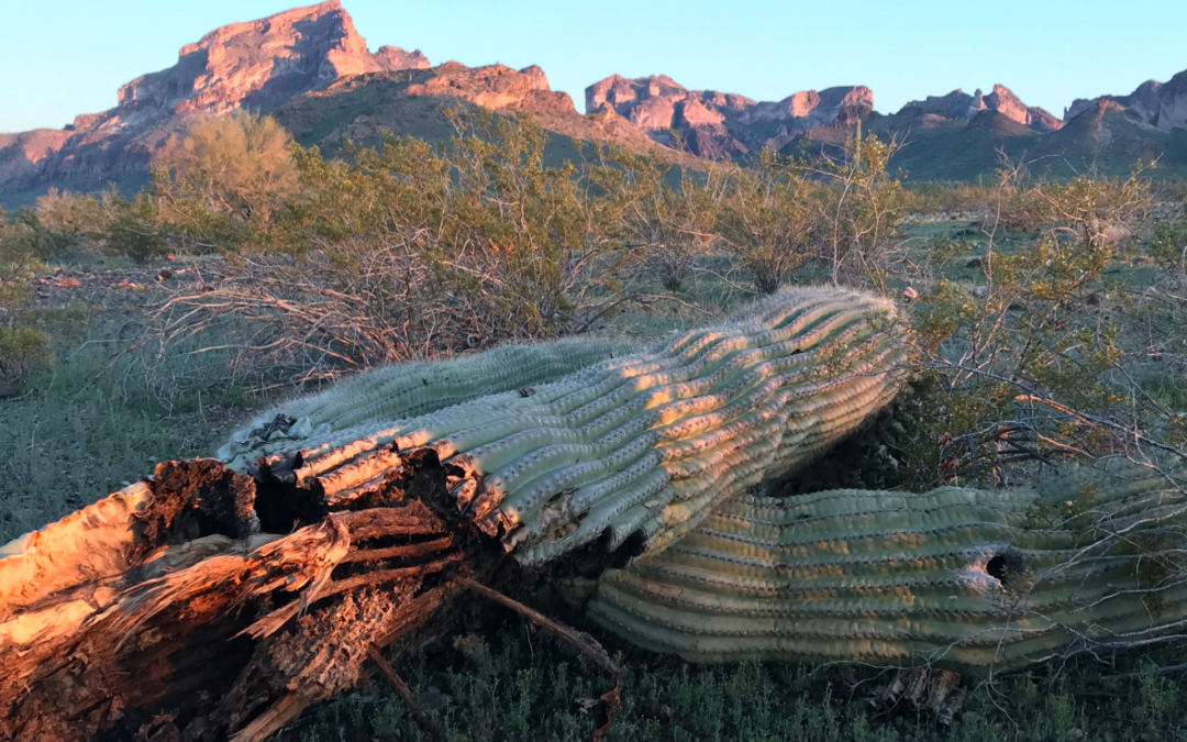
1. Eagletail Wilderness
Okay, so this area is not technically in the valley, but that is part of its appeal. The Eagletail Mountains are located about 20 miles west of Buckeye; and this wilderness is true Sonoran. Golden Eagles soar above, Gila Monsters waddle below, and the saguaros stand stately in their unique manner. A giant granite monolith greets visitors upon entering, and natural arches, five in fact, were witnessed by The Goat on his last visit to this wondrous place. He also witnessed something else to his liking: not a single other hiker. To come here is to witness the High Sonoran desert in its truly wild state.
So there it is my friends! Now get out there and hit the trails, and may The Goat be with you.
Photo Courtesy of The Goat, Eagletail Monolith, Eagletail Wilderness
Going Guided
Hiking and exploring the Sonoran Desert is a special experience. Although it is possible to see these places yourself, hiring a guide is a great idea. For instance, guiding services provide logistical support, and plan everything for your best possible trip. They provide a great safety net on the trail, and are trained in backcountry medicine. Above all, they provide a depth of knowledge of the region that turns a walk into a true adventure.
Blue Marble Adventure GeoTourism provides all of the support you need, and pairs that with expert geologist/guides. Our backcountry meals use fresh ingredients, and are planned by a professional chef. Furthermore, we provide top-of-the-line gear and passion for the places we explore. In conclusion, you can visit National Parks, but going with a guide can create and even more memorable experience. Don’t be shy, and call us!
Read our blog!
For adventure hiking vacations in a geologic time machine, see our epic tours in Grand Canyon, Utah, and Arizona!
For geological musings read The Goat’s geology blog.
Follow us on Facebookand Instagram
Thank you for sharing such a blog!
King regards,
Abildgaard Dencker